We turn hyperspectral observation into actionable intelligence that helps industries and governments see, measure and reduce emissions in real time
Customizable
State-of-the-art Data
Future-Proof Design
What We Do
Turning hyperspectral data into actionable climate intelligence.
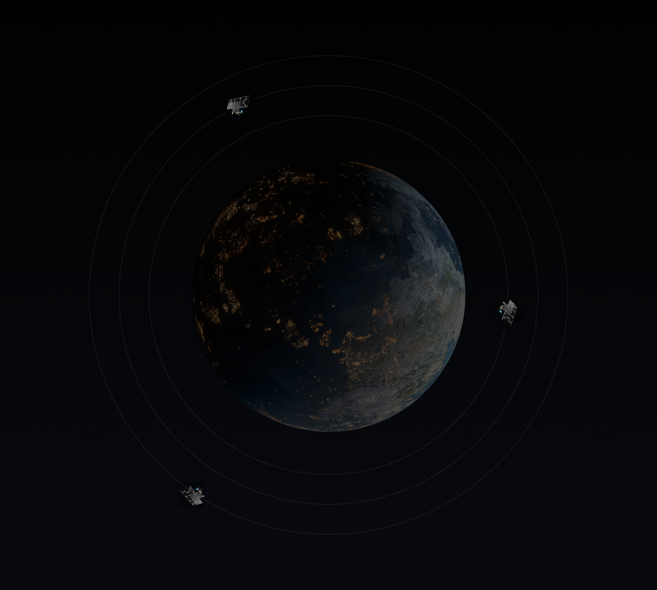
Spectrl Inc. operates a global data fusion platform that aggregates hyperspectral imagery from leading satellite constellations including NASA EMIT, DLR EnMAP, PRISMA, Pixxel, GHGSat and Carbon Mapper. Our proprietary AI engine identifies emission sources, quantifies their intensity, and generates verified reports compliant with EU and international climate regulations.
Satellites capture spectral signatures of methane and CO₂ at 1.65 and 2.3 μm bands.
Validate
Cross-sensor verification (EMIT, GHGSat, EnMAP) and ground truth correlation.
Report
Spectrl generates auditable MRV reports automatically for regulatory submission.
Analyze
AI models isolate true emission plumes and estimate mass flux using wind fields.
Fix
With validated and auditable data you enable teams on sight to fix issues faster and more precise.
Precision You Can Trust
Scientific accuracy. Industrial reliability.
Spectrl’s detection engine is built on rigorous validation. Each methane or CO₂ event is verified using multi-sensor cross-referencing (EMIT, EnMAP, GHGSat), atmospheric modelling, and ground-truth data from our pilot partners.
This ensures unmatched accuracy for operational and regulatory decisions.
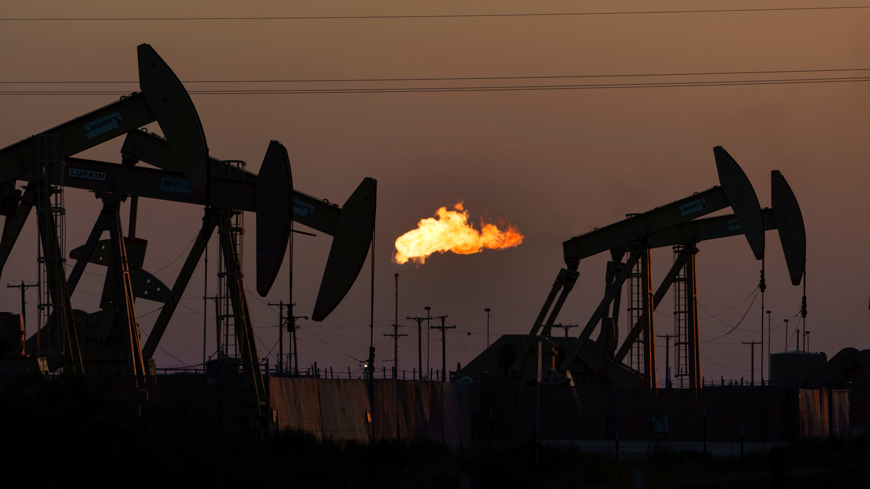
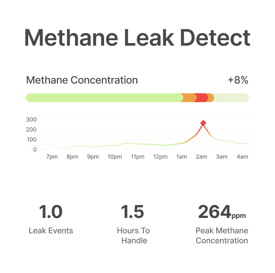
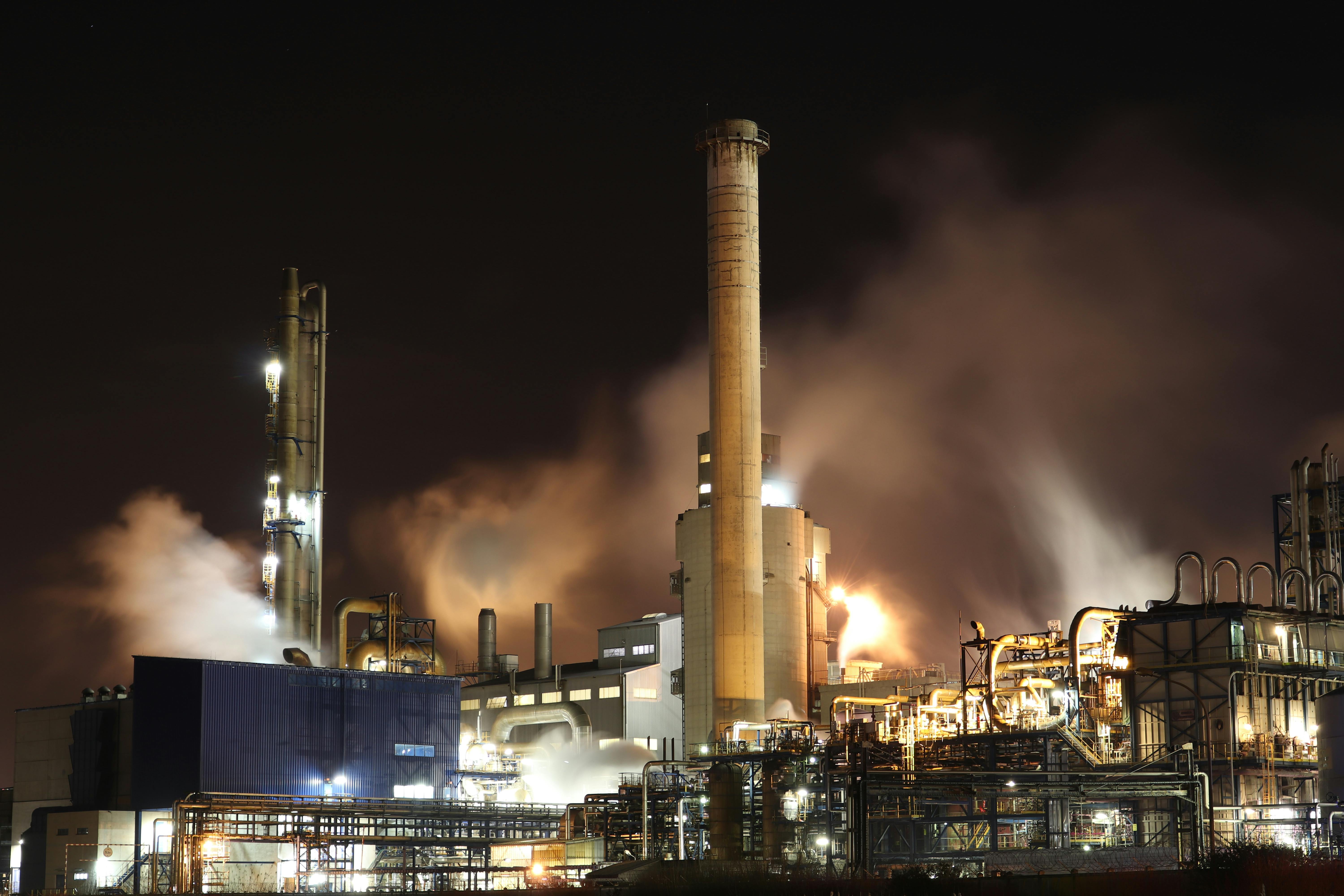
Monitors pipelines, storage facilities, and production sites for methane leaks using high-resolution satellite data and AI analytics.
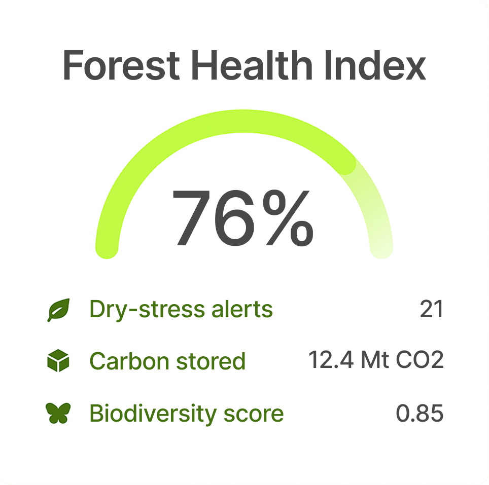
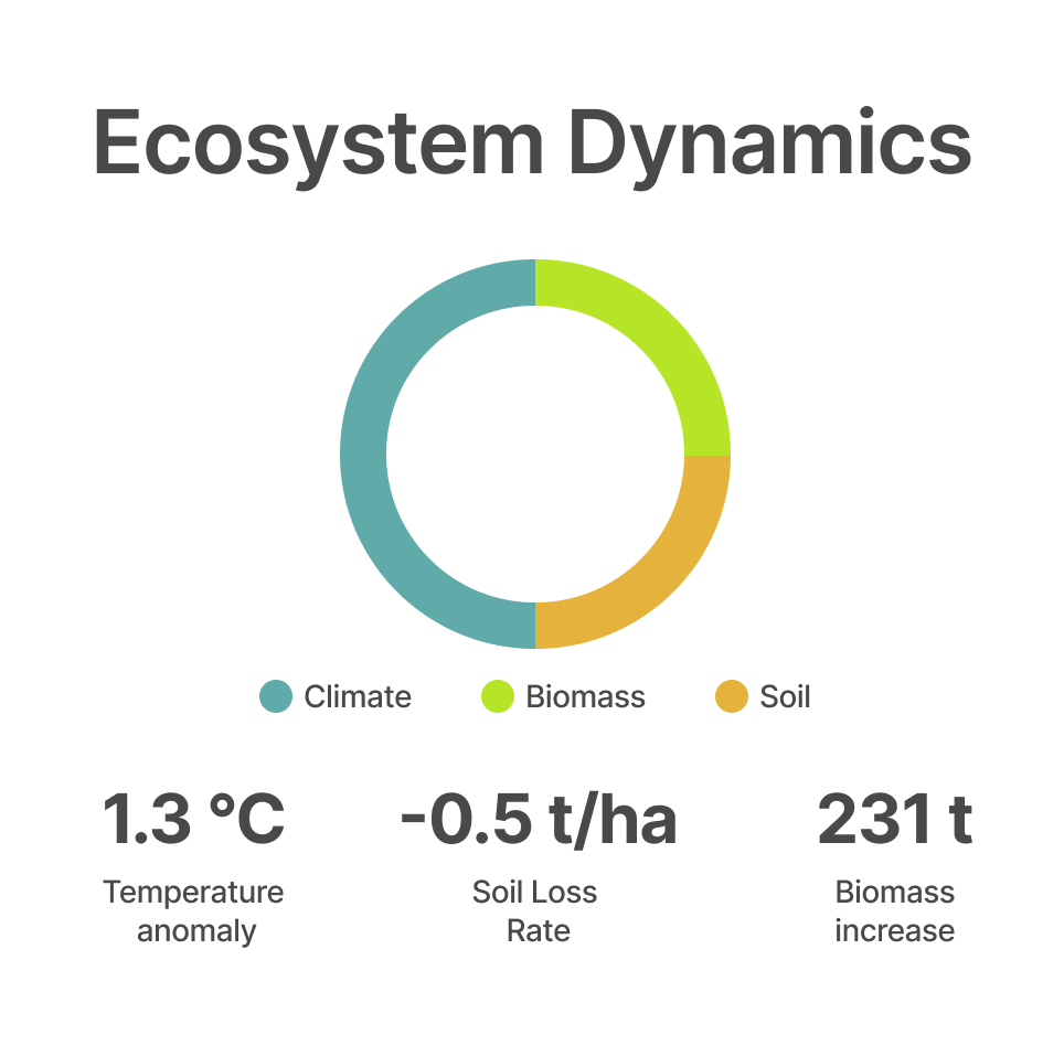
Forestry
Tracks forest health and biomass changes through hyperspectral imaging to identify deforestation, stress, and degradation in real time.
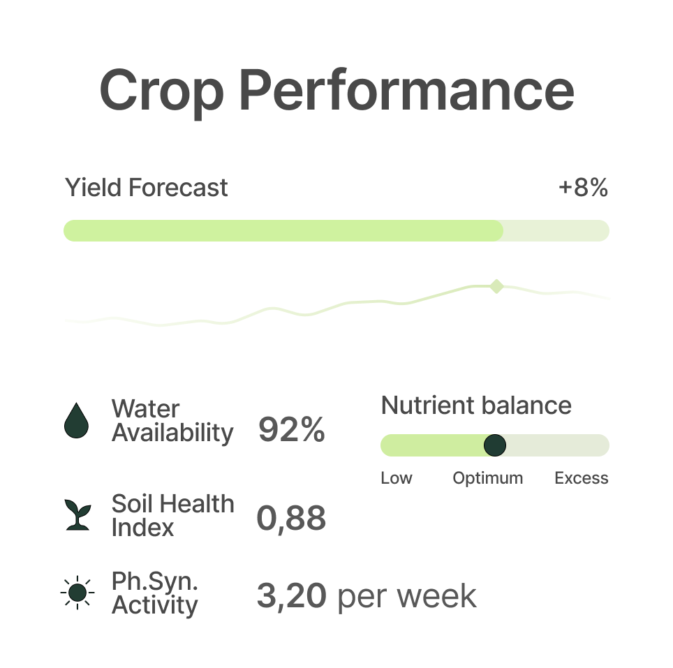
Agriculture
Analyses soil, crop, and fertiliser patterns to assess methane and CO₂ emissions across agricultural operations.
Governments
Provides verified satellite data and automated reporting pipelines for national MRV (Monitoring, Reporting, Verification) programs.
Energy & Utilities
Monitors gas distribution networks, refineries, and power infrastructure for leaks and operational anomalies.
Research & Academia
Offers hyperspectral datasets, AI tools, and analysis modules for environmental, atmospheric, and climate research.
Partners
Spectrl collaborates with global leaders in Earth observation, data science and energy to deliver verifiable climate intelligence.
Spectrl extends the impact of Pixxel’s hyperspectral data into industrial emissions, proving how space analytics drive real climate action.
Julek Cesar
CEO of Pixxel
Spectrl’s cloud-native architecture on AWS enables real-time satellite analytics at global scale.
Klaudia Czarna
CEO of Monolith
Spectrl helps us detect and verify methane emissions faster. A key step toward operational decarbonisation.
Jessica Mercedes
Marketer at FRANCO®
“Their fast shipping & branding made us stand out. We save hours every day”
Julek Cesar
CEO of terra-tory™
"We’ve really made a mark in the market. It’s incredible how much time we save each day!"
Klaudia Czarna
CEO of Monolith
"With their speedy shipping and eye-catching branding, we’ve truly distinguished o
Jessica Mercedes
Marketer at FRANCO®
FAQ
Common questions
What is Spectrl?
Spectrl is a hyperspectral data and AI company that detects and quantifies methane and CO₂ emissions from space.We integrate satellite imagery, atmospheric models, and AI analytics into actionable intelligence for industries and governments.
How does your technology work?
Spectrl fuses hyperspectral satellite data (from sources like EMIT, EnMAP, PRISMA, and GHGSat) with weather and ground-truth data.Our AI models identify methane plumes, calculate emission rates, and automatically generate compliance-ready reports.
Which industries do you serve?
Our solutions support oil and gas operators, utilities, agricultural companies, forest management agencies, and regulators. Each use case combines detection, verification, and reporting modules tailored to sector-specific standards.
Can Spectrl data be used for regulatory compliance?
Yes. Our reporting pipeline aligns with the EU Methane Regulation (2024/1787) and OGMP 2.0 Level 5 guidelines, ensuring data integrity, audit trails, and verified documentation for MRV (Monitoring, Reporting, Verification).
How accurate is Spectrl’s methane detection?
Our system detects emission events down to approximately 100–150 kg/h (depending on atmospheric conditions) with over 90 % detection confidence through multi-sensor cross-validation and machine learning quality control.
Do you own your satellites?
No. Spectrl partners with global providers such as Pixxel, GHGSat, Carbon Mapper, and DLR EnMAP. We focus on multi-source data fusion, advanced retrieval algorithms, and verified analytics rather than launching hardware.
Where is Spectrl data stored and processed?
All data are processed and stored in Austria and the European Union,fully compliant with GDPR and ISO 27001 data security standards.
Can I integrate Spectrl data into my existing systems?
Yes. We offer a secure API and dashboard for real-time access to emissions data, alerts, and compliance reports. Integrations are available for internal monitoring systems and ESG reporting platforms.
How fast can Spectrl detect and report a leak?
From satellite overpass to verified report, the average latency is under 12 hours, depending on satellite revisit time and weather conditions.
How can we start a pilot project with Spectrl?
Contact our partnerships team via the Request Demo form. We typically begin with a 90-day pilot focused on a specific region or asset, integrating satellite data, ground truth, and MRV reporting workflows.


-1976637031%20(1).png)